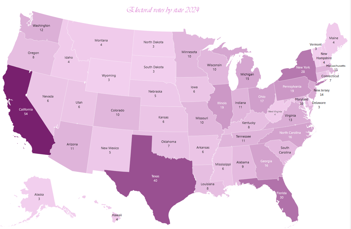
With the presidential election sneaking up fast, I thought it’d be good to get the latest electoral numbers by all states and District of Columbia based on the most recent census. So, here’s a map chart I created based on the published data.
TIP: Use your mouse wheel while holding down Ctrl key on your keyboard to zoom in or out.